Industries & Solutions
Reliable Geo-Analytical Solutions for each Industry. Powerful tools to help you in your decision-making process.

Accurate and reliable geographic data solutions for different sectors and phases, from initial to asset inspection
Ready to deploy our capabilities and provide you with a solution.
we are committed to quality and timeliness at every step of the process.
Infraestructure
Railroads · Airports
Ports
Urban & Rural Development & Planning
Infraestructure Services
urban improvements or infrastructure extension.
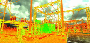
Utilities
Solar Farms
Wind Farms
Water & Waste
Oil · Gas · Mining
Oil Pipelines
Gas Pipelines
Mining
Oil · Gas · Mining
Environmental & Agricultural Studies
Hydrographic Basins
Drainage Basins
Forest Inventory
Environmental & Agricultural Studies
Why Choose Us
Let’s make it better together
We are totally oriented to our customers’ success in their projects, aligned with their goals. We stay connected working side with our clients before, during and after project execution.
Data Quality and Precision
We strive to offer precise and reliable data for your projects. Previous to any project we carry out a deep analysis to recommend the most effective way to deliver the data.
Experience and Reputation
With more than 530 projects executed and nearly 100 customers we have built a solid reputation in our markets.
Resources
We use last generation data acquisition equipment LiDAR, Cameras, bathymetric, mounted in different aerial, satellite platforms, land and our great team.
Cost and Delivery Time
Budgets without subsequent surprises, and delivery times with strict compliance.
Our quality and our care for the environment are certified


Combine Global Experience with Local Agility to Drive Your Project to Success
We have a robust team of experts accumulating a strong know-how. Our personalized attention ensures your project is analyzed adequately in terms of data to be captured, processing and end-products to precisely meet the goals of your project.
Milestones & Value Chain
It’s time to think about the best for your project
Our clear working process will give you the confidence and peace of mind of having the information necessary to develop your assets.
We analyze the needs of the project and select the most appropriate base data and acquisition platform (satellite, airplane, helicopter, drone, boat, mobile, terrestrial) together with the most adequate sensor.
We acquire the data, run it through various processes to deliver a full dataset from raw to final products together with a Final Report. Afterwards these products are used for other analysis such as flood risks, landslide risks, physical asset analysis etc.
We offer our customers several option to visualize the Digital Twin of a given project. We also add enriched features to enhance Customers’ experience and the ability to have several departments interacting with the data (O&M, Finance, etc.). In parallel all data is secured in cold storage.
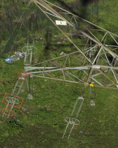
Other layers of services are added from generation of specific reports for powerline & pipeline inspection (vegetation management, mechanical anomalies, illegal invasions, etc.) to geo-risks maps (landslides, reservoir capacity, flooding risks etc.) and new designs in greenfield projects.
Latest post
Insight

Driving Excellence: How SIGLA Achieved ISO 9001, 14001, and 45001 Certifications in 2025
In the competitive arena of large-scale projects, having solid and internationally recognized management systems is not an option—it is a necessity. Since its inception, SIGLA

Digital Twins: Geospatial Intelligence to Optimize Large Projects and Strategic Assets
Digital twins are revolutionizing the management of strategic assets by providing real-time virtual models of infrastructures, power grids, and production plants, among other applications. Thanks to this technology, companies can anticipate failures, optimize operations, and make data-driven decisions. From urban planning to wildfire or flood prevention, digital twins enhance efficiency and reduce costs across multiple sectors. Discover how this tool can transform your industry and ensure a more efficient and sustainable future.

Power Line Inspections
SIGLA has been working for several years in Power Line Inspection projects within Framework Agreements with largest utility companies in Latin America, in High, Mid

